The Land Registry Under Occupation Control: How ‘Israel’ Is Leveraging the Registration of ‘Area C’ Lands for Annexation
The process starts with “Israel” designating a parcel of land for settlement and then requiring each claimant with a legal interest in it to provide proof of their rights.
“Israel” is placing ownership of vast areas of the West Bank before a final adjudication process managed by occupation authorities, beginning with the selection of areas to be included in the land settlement process and the examination of ownership documents, and extending to the ruling on objections and the issuance of the final land registry.
At the heart of this process is Area C, which constitutes about 60 percent of the West Bank and includes most of the settlements, as well as large areas of agricultural land and the future urban expansion reserves of Palestinian villages.
A significant portion of Area C has remained outside final registration since the occupation formally halted land settlement procedures in 1968.
Under the “Oslo II Accord,” signed in 1995, the West Bank was divided into three areas: “A,” “B,” and “C.” Area A is under full Palestinian control, while Area B is under Palestinian civil control and Israeli security control. Area C, meanwhile, is under full Israeli control.
Reshaping Property Ownership
On May 25, 2026, the Israeli government launched a new digital platform for land transactions in the West Bank, covering first-time registration, sales, mortgages, inheritance, wills, and the issuance of land registry records.
Three days later, the Ministry of Justice issued a public tender to select an entity responsible for managing land settlement procedures in the West Bank and East Jerusalem.
The move shifted the project from government decisions into the establishment of an administrative body capable of receiving ownership files, conducting surveys, and preparing rights schedules.
The platform and the tender followed a government decision on February 15, 2026 that restarted the land settlement process in Area C and set a target of registering at least 15 percent of unsettled land by the end of 2030.
The Israeli occupation government allocated 244.1 million shekels to the process (with $1 equal to 3 shekels) and created 35 new positions within the bodies involved in implementation.
This turned land settlement into a multi-year, government-funded program rather than a limited procedure initiated by an individual landowner.
The so-called Israeli Land Registration and Settlement Authority within the Ministry of Justice is leading the project, with the participation of the Survey of “Israel”, the Civil Administration, and the legal and security departments of the Ministry of Defense.
The roots of the process go back to land settlement procedures that began during the British Mandate and were continued by the Jordanian administration under the Land and Water Settlement Law of 1952.
Authorities would designate a specific land area, survey its properties, examine claims by rights holders, publish a preliminary ownership schedule, receive objections, and then issue the final registry.
When the West Bank was occupied in 1967, the process had been completed in approximately 30 to 34 percent of its territory, while most of the land remained outside the final land registry.
On December 19, 1968, the Israeli military governor issued an order suspending land settlement procedures and preventing the opening of new cases.
At the time, the decision was based on the presence of large numbers of owners and heirs outside the West Bank, the absence of some Jordanian records, and concerns over determining the rights of people who could not appear or provide documentation.
The official freeze continued for more than five decades, while a limited process known as “first registration” remained available, allowing the registration of individual plots upon private request.
This registration was costly and complicated, as applicants had to cover surveying expenses, public notices, lawyers’ fees, and charges that could approach 5 percent of the land’s value.
Israeli settlers and companies benefited from this registration process to formalize purchase agreements and ownership claims, while many Palestinians avoided it because of the costs, procedural difficulties, and lack of trust in Israeli institutions.
The new process, however, is initiated by the Israeli occupation government itself across entire land areas, which funds and manages it until a final registry is issued for all plots within those areas.
The February decision was preceded by years of institutional preparation. In its 2019 report, the Israeli military prosecution noted that it was examining the resumption of land settlement in cooperation with the Ministries of Justice and Defense and the Civil Administration.
On May 11, 2025, the Israeli security cabinet (“the Cabinet”) issued a decision to begin land settlement procedures in Area C, tasking the commander of Israeli forces in the West Bank with restarting the process and preparing the necessary military amendments.
The February decision then transformed this directive into an operational program with a budget, staff, and timeline.
When “Israel” selects a land area for settlement, every Palestinian claiming rights to that area becomes required to submit ownership documents, proof of inheritance chains, and evidence of possession and cultivation within the specified deadlines.
After surveying and investigation, Israeli authorities prepare a preliminary rights schedule and publish it for review, then open a period for objections of up to 30 days under Jordanian law.
Disputes are subsequently referred to the Land Settlement Court before a final land registry is issued identifying the owner of each plot and its boundaries.
The Israeli government has not yet published the names of the villages or land areas that will be included in the first phase. The published decision only specifies the target percentage, budget, and implementing bodies.
The Israeli anti-settlement organization Peace Now estimates the size of Area C at approximately 3.3 million dunams, of which around 1.9 million dunams remain outside final registration. This means that the 15 percent target could cover roughly 290,000 dunams by 2030.
Israeli documents indicate that building the full implementation apparatus may take around a year and a half, and that settling each land area may require a similar period or longer.
In this way, “Israel” is establishing a gradual process through which it will reshape the land ownership registry in Area C, while already building the digital and administrative tools that will manage the process in the coming years.
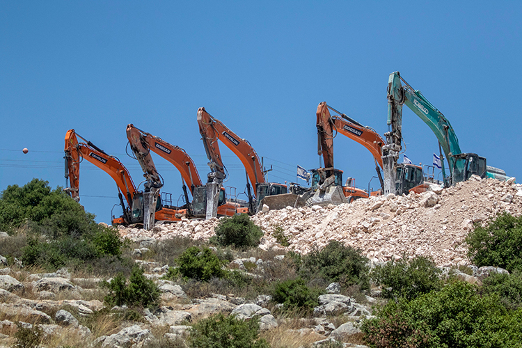
Who faces losing their land?
Estimates of the number of Palestinians living in Area C, or in communities that extend into it, vary between 180,000 and 300,000 people.
The United Nations Office for the Coordination of Humanitarian Affairs in the occupied Palestinian territory (OCHA) has estimated that around 300,000 Palestinians live in approximately 530 residential communities located wholly or partly in Area C, including 241 communities located entirely within it.
The circle of those affected extends to Palestinians living in Areas A and B, while their agricultural lands, grazing areas, and the future urban expansion reserves of their villages are located within Area C.
For this reason, it is difficult to limit the impact of the registration process to residents of Area C alone; its consequences extend to Palestinian families and villages that depend on these lands for agriculture, housing, and future expansion.
Palestinian documents vary between final registration records, historical evidence, and indications of possession. The strongest of these documents is the final registration completed by the British or Jordanian authorities, because the plot’s area and boundaries are defined and it is registered under the name of a known owner.
However, the suspension of land settlement in 1968 left the majority of land outside this registry and forced owners to rely on documents of varying evidentiary value before Israeli authorities.
At the forefront of the older documents is the Ottoman kushan or tapu (land deed), a document that proves the right of disposition over land. However, in many cases its boundaries were described using references to neighbors, trees, roads, and valleys.
After more than a century, landmarks have changed and land has been divided among heirs, making it necessary to use experts, surveys, and a complete chain of ownership transfers to link the old deed to a modern parcel.
The dispute may shift from the validity of the kushan itself to the location of the land and the area it actually covers.
Jordanian tax records and property tax documents provide evidence of a person’s connection to the land and payment of taxes on it, but they usually contain limited information about boundaries and area, and they remain weaker than final registration.
As for the claim registers prepared during Jordanian land settlement procedures that stopped before the issuance of final records, their value varies depending on the stage reached by the investigation before the occupation.
The weight given to these documents is subject to the interpretation adopted by Israeli authorities when examining each case.
As a result, heirs face one of the most complicated situations. Much of the land remains registered in documents under the names of grandparents or fathers, while shares have been divided among dozens of sons and grandchildren without formal partition or updated registration.
Proving ownership requires inheritance documentation, a complete chain showing transfers between generations, and identification of the shares belonging to all partners. Some heirs may be in Jordan, refugee camps, or other countries.
The absence of one heir or the inability to collect their documents can make part of the land vulnerable to disputes or treatment under “abandoned property” and absentee property laws.
Communal lands (masha‘), shared by families or villages according to customary arrangements, face a similar challenge. During the Ottoman period, Palestinians maintained collective ownership arrangements, and some avoided individual land registration due to fears of increased taxation or the use of records to impose compulsory military service, in addition to factors related to agricultural practices and the sharing of land among families.
When such lands enter a final settlement process, each partner becomes required to prove their share and its boundaries. A single dispute or missing document can disrupt the rights of a large number of families.
For farmers and herders, part of their rights depends on possession and actual use of the land under Ottoman land law.
The Israeli Civil Administration has developed a restrictive interpretation of the agricultural-use standard, requiring in some lands with intermittent cultivation that more than half of the plot be cultivated, while grazing and wood collection are excluded from forms of use that establish rights.
This interpretation threatens rocky hillsides, grazing lands, and rain-fed agricultural areas whose cultivation depends on rainfall and seasonal cycles.
The risk increases when the interruption of cultivation results from occupation policies. Checkpoints, settlements, outposts, military roads, and settler attacks have prevented some landowners from accessing their lands for years. Later, the decline in cultivation may be used as a basis to challenge the continuation of their possession.
The Israeli legal organization Yesh Din has warned that losing access to unregistered private land weakens owners’ ability to meet the agricultural-use criteria applied by the Civil Administration.
Notification and objection procedures create an additional risk. The publication of a rights schedule begins a fixed legal deadline, while landowners and heirs are dispersed among villages, cities, refugee camps, and different countries.
The Norwegian Refugee Council documented a case in Bil’in in which the Israeli authorities declared around 125 dunams as “state land” in 1990, but it later emerged that the declaration document lacked the signature of the village mukhtar, proving that he had not received the notification.
The case illustrates how failures in notification procedures can deprive landowners of the opportunity to submit objections within the required timeframe.
Families also need lawyers, surveyors, and experts in Ottoman and Jordanian documents, as well as maps linking historical descriptions to modern coordinates. In contrast, the government has surveying agencies, records, budgets, and specialized legal teams at its disposal.
This imbalance in resources creates a battle over evidence before institutions controlled by the party that controls the land and determines the criteria for accepting proof.
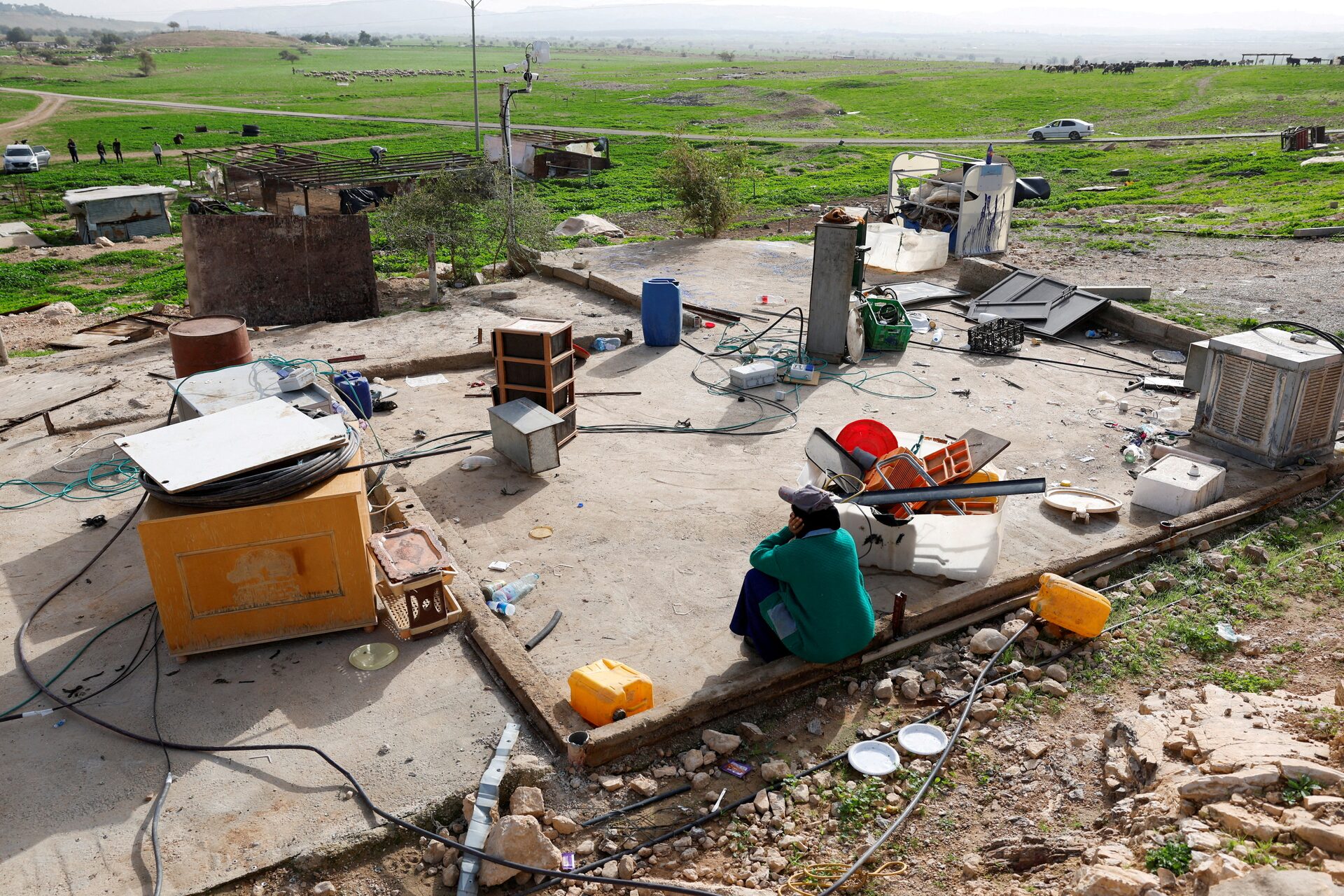
The damage extends to entire villages even when disputes concern lands outside built-up areas. Unregistered lands constitute fields, grazing areas, sources of income, and the reserves needed for future construction of homes, schools, and roads.
When surrounding hills and plains are registered in the name of the “state,” villages lose their natural space for expansion and become population centers confined within an area managed by settlements and Israeli councils.
How Does Land Registration Become Annexation?
The process begins with “Israel” selecting a land area for settlement, and then requiring every person claiming a right to it to submit their claim and supporting documents within the specified deadlines.
After reviewing applications and objections, plots whose ownership is proven are registered in the names of their owners. Meanwhile, the rejection or absence of claims opens the way for the land to be registered as “state land.”
The final registry gives this classification broader legal weight in property matters and narrows the possibility of future Palestinian claims to the land.
The policy of allocating “state lands” reveals which party benefits from this outcome, according to a report published by the Israeli organization Peace Now on July 17, 2018, based on data it obtained from the Civil Administration.
The data showed that 99.76 percent of government land allocated for any use in the West Bank, amounting to approximately 674,000 dunams, was allocated to serve Israelis and settlements.
Palestinians received 0.24 percent, or around 1,625 dunams, a large portion of which was linked to the relocation of Bedouin communities or arrangements serving Israeli projects.
These figures give practical meaning to registering land in the name of the “state”: the plot then becomes part of a pool of land that can be allocated for settlements, roads, industrial zones, and settlement councils, while Palestinian projects remain subject to planning and construction restrictions imposed by the Civil Administration.
The Israeli human rights organization B’Tselem estimates that “Israel” has declared or registered around 1.2 million dunams in the West Bank as public land under its administration, equivalent to approximately 22 percent of the area.
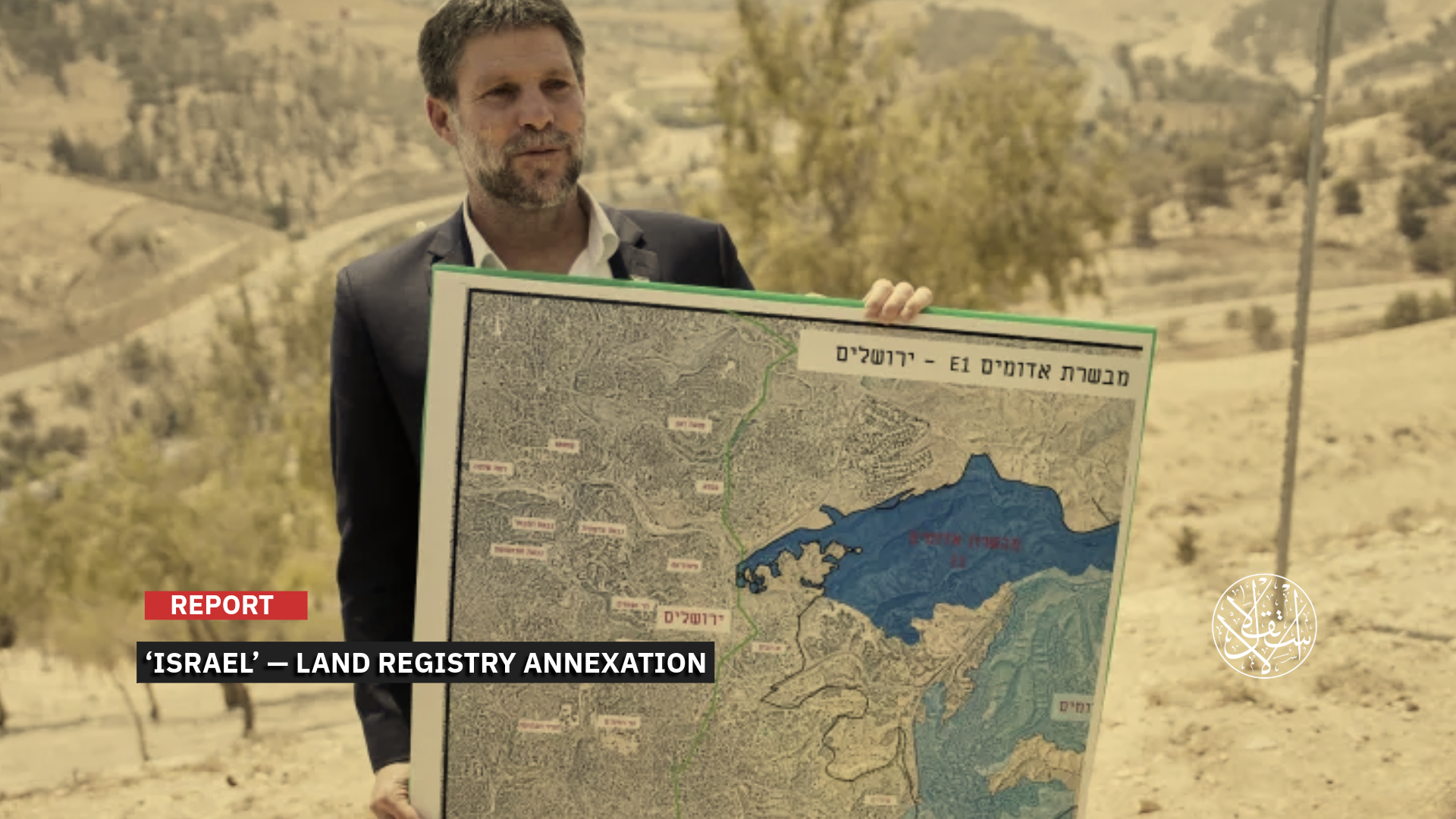
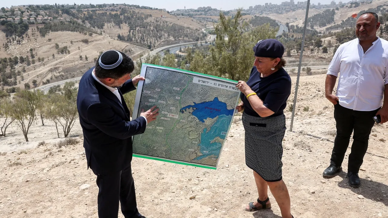
Finance Minister and additional minister in the Ministry of Defense Bezalel Smotrich outlined the political objective of the process in remarks accompanying the Cabinet decision in May 2025.
He said that “Israel” was taking responsibility for the land for the first time as a “permanent sovereign,” and that the settlement process would provide reserves for the development of settlements.
Israeli Defense Minister Israel Katz, for his part, described the move as one that would strengthen and expand settlements.
The registration process operates alongside a broader package of measures. On February 8, 2026, the Cabinet approved measures facilitating Israeli purchases of land in the West Bank, opening ownership records to Israelis, reviving a government committee for land acquisition, and expanding Israeli enforcement powers in areas nominally under Palestinian administration.
The decision to settle Area C came one week later, placing registration, acquisition, and allocation within an integrated system that expands Israeli control over the land.
Since 2023, Benjamin Netanyahu’s government has transferred increasing powers related to planning and settlement from the military leadership to civilian bodies under Smotrich within the Ministry of Defense.
These changes expanded the role of Israeli officials in managing land and planning affairs, while Palestinians have remained subject to military orders and occupation courts. The new registration process shifts another aspect of Area C’s administration to Israeli state institutions.
The case of the Haroei outpost south of Nablus provides a recent example of the fate of “state land.” On June 24, 2026, the Civil Administration declared 465.4 dunams of land belonging to Sinjil and al-Lubban al-Sharqiya as state land, with the aim of legalizing the outpost.
Buildings in Haroei occupy around 100 dunams, while the declaration covered an area more than four times larger, allowing for the creation of a wider planning and expansion zone around it. The Civil Administration gave landowners 45 days to submit objections and prove their ownership.
This case illustrates the gap between existing structures and the area of control created through land procedures. Declaring land as state land prepares it for allocation and planning, after which roads, water networks, security infrastructure, and areas under settlement council control can be incorporated.
Palestinian plots enclosed within this zone become increasingly difficult to access and use, even when they remain registered under their owners’ names.
The same approach appeared in the case of the Evyatar outpost, when “Israel” declared around 66 dunams as state land in July 2024 in order to provide a legal basis for its legalization.
A similar pattern occurred at the Nativ HaAvot outpost west of Bethlehem, where a previous declaration covered areas beyond the built-up section of the outpost.
In these cases, “state land” maps are used to define expansion areas around outposts and isolate the remaining privately owned Palestinian lands within a settlement perimeter.
The settlement of Ofra, however, demonstrates the importance of final registration from the opposite perspective. The lands of Ein Yabrud, Silwad, and Taybeh underwent settlement procedures during Jordanian rule and were registered in the names of their Palestinian owners before the occupation of the West Bank in 1967.
This prevented “Israel” from declaring them “state land” through the usual process, despite parts of the settlement being built on privately registered land.
This precedent shows that final registration can protect property rights, while that protection becomes a risk when the occupying authority itself determines the evidence, examines claims, and issues the registry.
The Palestinian legal organization Adalah, which works inside the areas occupied in 1948, along with the organizations Yesh Din and Peace Now, argue that land settlement carries a permanent sovereign character that conflicts with the temporary status of an occupying power.
These organizations argue that “Israel” is concentrating in its own hands the authority to select land, amend laws, conduct surveys, resolve objections, and then manage and allocate lands registered as state property.
This process enables the expansion of administrative annexation without waiting for a comprehensive law formally declaring the annexation of Area C.
The registry is issued by the Israeli Ministry of Justice, surveys are conducted by an Israeli government institution, allocation is managed by the Civil Administration according to settlement policy, and ownership of the land ultimately transfers to the occupying state.
Under this process, Palestinians face a state that halted land settlement for decades, restricted access, agriculture, and construction, and then reopened the issue under its own conditions and institutions.
As a result, the tapu, originally a document intended to protect ownership, becomes a tool through which “Israel” redraws the West Bank and incorporates its land under the cover of land registration.