Southern Lebanon Without Bridges: Is the Isolation of the Litani River a Prelude to a New Israeli Occupation?
“For decades, the Litani River in Lebanon has been intertwined with Israeli security perceptions.”
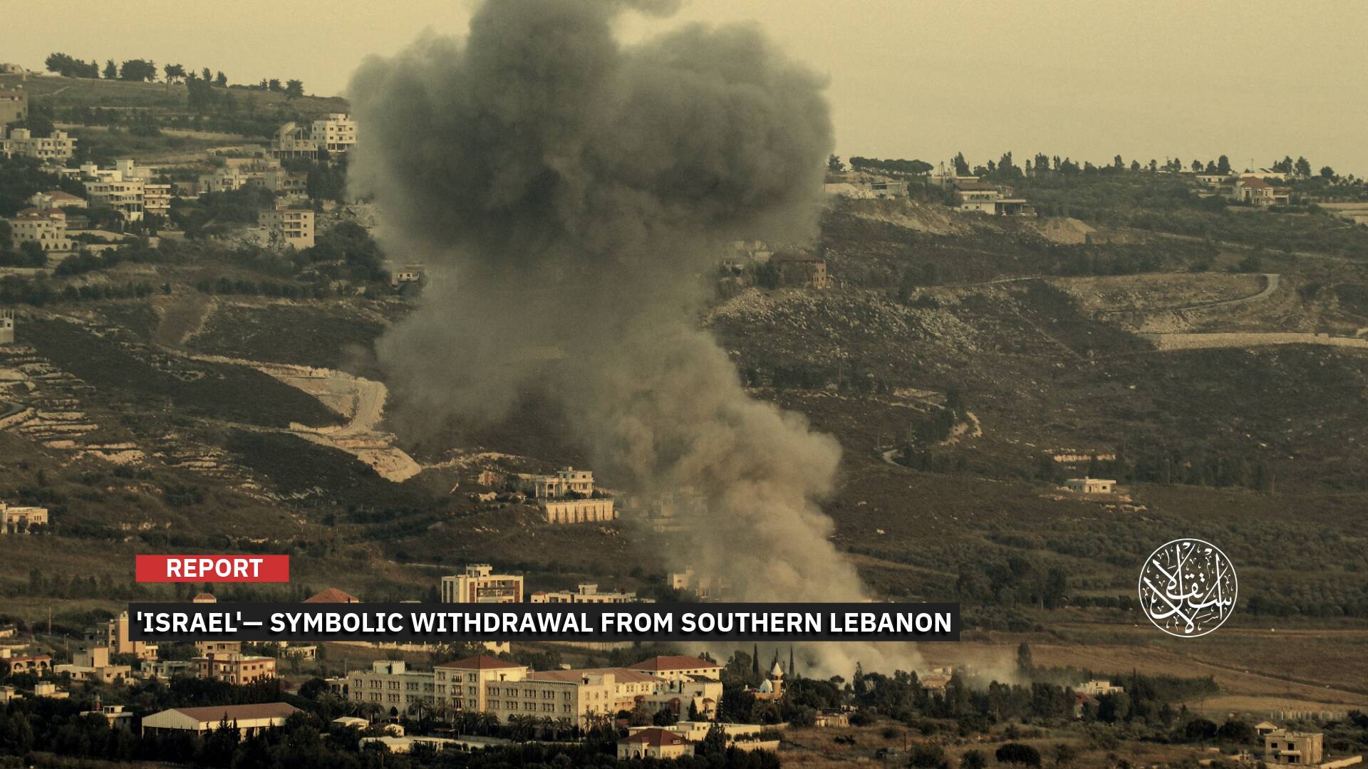
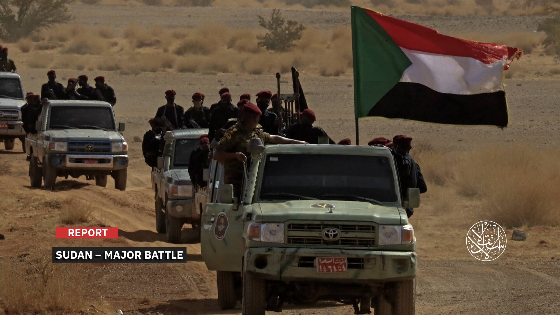
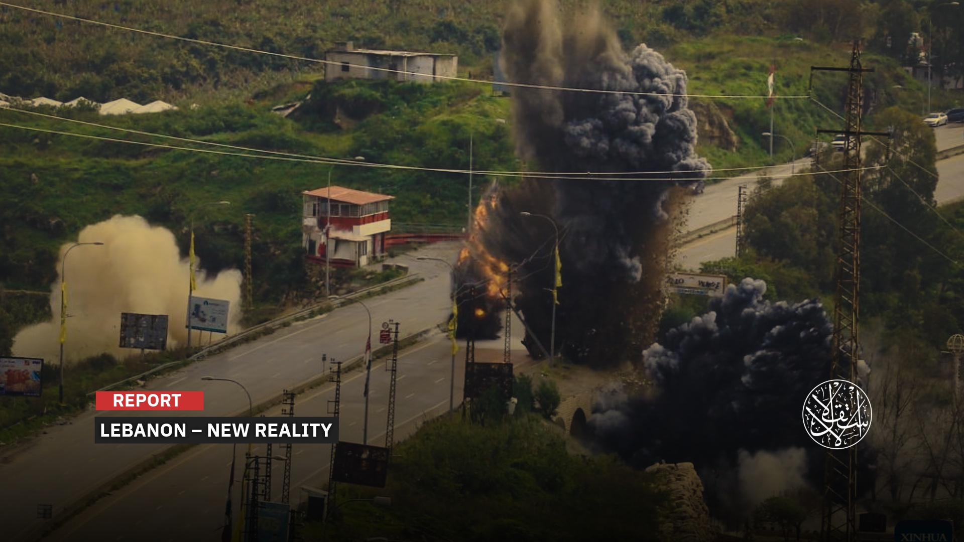
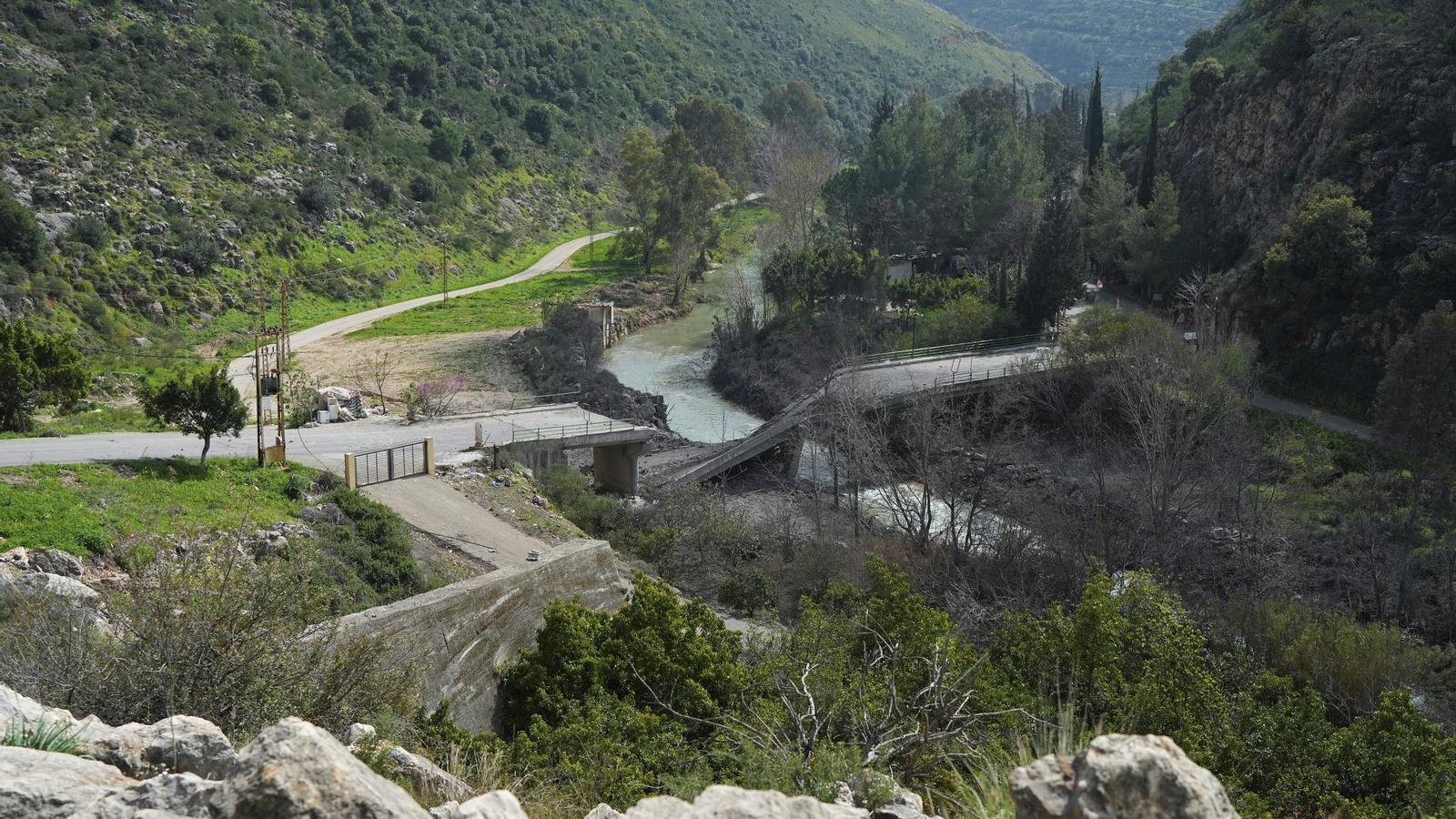
By the end of March, the landscape along the banks of the Litani River in southern Lebanon had shifted dramatically after the Israeli occupation army destroyed most of its crossings and bridges as part of its plan to expand its borders and control the region.
This aggression, which began after Hezbollah joined the battle alongside Tehran in the context of the U.S.-Israeli war on Iran, was accompanied by Israeli political statements hinting at a new occupation under the guise of a border arrangement.
Key Bridges
Seven permanent bridges and crossings span the Litani River in its southern section, forming the primary link between the coast and the interior.
These include four key bridges: Qasmiyeh, Khardali, Qaqaiya, and the crossing connecting Zrarieh and Tayr Felsay.
The smaller bridges and crossings are distributed along secondary routes, most notably the old Qasmiyeh crossing and the Zrarieh secondary crossing.
The significance of this limited number of bridges stems from the fact that any simultaneous targeting of them not only disrupts traffic but also effectively transforms the Litani River itself into a dividing line between southern Lebanon and the rest of the country.
The recent strikes targeted the Qasmiyeh coastal bridge, the Qaqaiya bridge, the Zrarieh-Tair Falsay bridge, the eastern crossing known in some sources as the Dalafa bridge, a secondary crossing near Qasmiyeh, and the road leading to the Khardali bridge.
Specifically, on March 13, “Israel” announced for the first time that it had bombed Zrarieh on the Litani River, claiming that Hezbollah was using it to move between the north and south of the river.
In the same statement, Army Minister Israel Katz warned that the Lebanese government would pay an increasing price through the destruction of infrastructure and the loss of territory if Hezbollah was not disarmed.
Five days later, Katz announced that his army had destroyed two more bridges over the river but did not specify their locations. Lebanese media reported that the strikes also targeted a road leading to the Khardali bridge at Wadi al-Hujair.
On March 22, Israeli warplanes bombed the Qasmiyeh Bridge on the coastal road linking Sidon and Tyre twice. This bridge is a key crossing for civilians and supplies. Military orders were then issued to destroy all crossings over the Litani River.
On March 24, the Israeli army had struck another major crossing, the Dalafa Bridge, explaining that it had already destroyed all the bridges used by Hezbollah and seized the remaining ones to establish a security zone up to the Litani River.
Two days later, Katz confirmed to Reuters that five bridges had already been destroyed and that the army would continue destroying the remaining ones and establish control over the security zone up to the Litani.
However, The Washington Post reported the destruction of all seven bridges along the river, while the UN Office for the Coordination of Humanitarian Affairs (OCHA) counted seven major and minor crossings in the area, some completely destroyed and others rendered unusable.
According to an update issued by the OCHA, airstrikes between March 22 and 23 disrupted three major crossings – the Qasmiyeh, Qaqaiya, and Dalafa bridges.
The Israeli Alma Center for Research stated that the army targeted six major bridges or crossings up to March 24.
The bombing of the Qaqaiya bridge, which was already damaged, rendered it completely unusable. The bombing of the Dalafa bridge, which connects Hasbaya and Marjeyoun to Jezzine, the Western Bekaa, and the Chouf, further isolated the eastern part of southern Lebanon from the west.
Geographical Isolation
The targeting of bridges is not simply about destroying infrastructure over a river; the Israeli occupation is bringing the war into civilian areas, redrawing the map of the region, and turning the river into a de facto barrier.
According to an OCHA report, the destruction of the Qasmiyeh (main and internal) and Qaqaiya and Dalafa crossings has isolated more than 150,000 people in southern Lebanon from the coast and the plains, severed the coastal road between Tyre and Sidon, and disrupted connectivity between the coast and the southern interior.
Access to food and medicine has become dependent on narrow agricultural roads winding through banana groves, while patients can take hours to reach the nearest hospital in the north.
Families displaced to villages in the Bekaa Valley are unable to return because roads along the Litani River have been cut off by Israeli shelling.
This isolation extends to economic sectors. For example, the Dalafa bridge was a vital artery for vegetable traders and olive farmers transporting their produce from Hasbaya and Marjeyoun to the markets of Sidon and Mount Lebanon.
Its destruction has forced them to use mountain roads, increasing transportation costs and exposing them to the risk of shelling.
Similarly, the destruction of the Qaqaiya bridge has separated Nabatieh and Bint Jbeil, impacting the movement of residents and students.
In contrast, civilians used the internal bridges after the main Qasmiyeh bridge was destroyed, but subsequent bombing rendered them unusable, leaving only narrow passages through banana groves.
The impact of these strikes on Hezbollah is no less significant; the targeted bridges connected the east and south, encompassing the Nabatieh and Western Bekaa Valley, with the west, where the coastal villages are located. These routes provided lines for supplying weapons and provisions and for rapid redeployment.
The destruction of the Zrarieh bridge and the surrounding area of Dalafa also hampered the transfer of reinforcements from the Tyre district to the Jezzine region and prevented the rapid redeployment of forces.
As for striking the road leading to the Khardali bridge, it severed the connection between Marjeyoun and the Western Bekaa Valley, where Hezbollah is believed to utilize the mountainous terrain for its troop movements.
Cutting off these crossings not only harms Hezbollah, but also increases the pressure on the population, forcing them to remain in the confrontation zones or flee via treacherous roads.
According to Israeli military claims, the strikes aimed to prevent the transfer of reinforcements and weapons from Hezbollah to the south. However, the practical result was the isolation of residents from hospitals, schools, and markets.
The damage was not limited to roads. The strikes damaged water pipes in Marjeyoun and a power station in Sultaniyeh, increasing the risk of water shortages and power outages.
The strikes also complicate coordination between civil defense and humanitarian organizations.
A memo from OCHA indicated that the damage to the crossings significantly disrupts humanitarian access, and that the region has become reliant on small boats to transport the sick and deliver aid.

New Occupation
For decades, the Litani River in Lebanon has been intertwined with Israeli security perceptions. The idea of a security zone between the border and along the river emerged during the 1978 invasion and the 1982 war.
Resolution 1701 of 2006 reaffirmed the Litani as a reference security line, calling for the establishment of an area between the Blue Line and the Litani free of any personnel, weapons, or military assets not belonging to the Lebanese state and UNIFIL.
This resolution made the river a hypothetical line for defining an area free of Hezbollah weapons, but it did not address a permanent border and did not grant Israel control over the northern bank.
In this context, the Litani River is not viewed merely as a Lebanese waterway, but as a strategic asset that redefines the geography of southern Lebanon.
It is the longest and most abundant of Lebanon's rivers, originating, flowing, and emptying entirely within Lebanese borders, making it a purely national resource with no legal claim to it by any other country.
Furthermore, its location, stretching from the Bekaa Valley to the sea north of Tyre, gives it a significance that transcends the water itself.
It forms a natural boundary separating the south from the rest of the country, simultaneously linking this vital resource to its geopolitical importance.
The Litani's importance also stems from its role as an economic and water artery for Lebanon. Its waters supply vast areas of towns, support irrigation projects, and serve agricultural lands in the Bekaa Valley and the south. It also plays a crucial role in electricity generation through the Qaraoun Dam and Lake.
Therefore, the river appears to be a critical element in water, food, and economic security, not merely a dispensable natural resource, according to a previous study published in the Journal of Palestinian Studies.
The study added that Israeli targeting of bridges on the Litani River is a direct means of exerting pressure on the ability of southern Lebanon to withstand the challenges, and on the stability of its residents and their daily lives.
Military and strategic expert Hassan Jouni stated in a television interview that targeting bridges over the Litani River is linked to Israeli ambitions regarding the river's historical waters, ambitions that began with the establishment of “Israel”.
He added that the bridges are of great military importance because they serve as crossing points or choke points; meaning that closing or destroying them prevents the movement of heavy and light vehicles.
He pointed out that blowing up the bridges aims to weaken Hezbollah's ability to cross into Israeli-held areas, but it does not eliminate the possibility of such crossings.
From a military perspective, the Litani's importance lies in its topography. Its course, particularly in its western section, forms a complex natural barrier surrounded by deep valleys and rocky gorges, making the area south of it more like a geographical enclave that can be isolated and its access points controlled.
Therefore, controlling the southern bank of the river, or the crossings leading to it, has value that extends beyond its immediate strategic importance.
According to the Center for Strategic and International Studies (CSIS), controlling these areas grants the power to control movement and militarily isolate southern Lebanon at a relatively low cost.
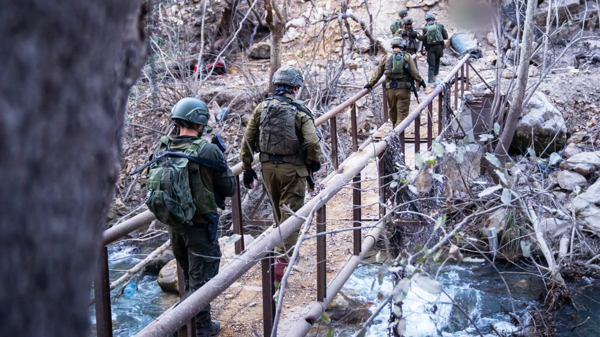
Prime Minister Benjamin Netanyahu confirmed that “Israel” is expanding the buffer zone to move the threat of anti-tank missiles away from northern towns.
Meanwhile, Israel Katz stated that the army will take control of the Litani Bridge and establish a security zone extending to the river, emphasizing that Israeli forces will control the remaining crossings.
In parallel, widespread evacuation orders were issued for residents, and homes and agricultural lands were destroyed. Officials spoke of a new security zone and borders.
These statements are consistent with the model Israel is using in the Gaza Strip, where it established a large buffer zone by destroying homes and agricultural lands.
Katz also hinted that the operations in Lebanon are following the Rafah and Beit Hanoun model.
But what is striking is the statement by the far-right Finance Minister Bezalel Smotrich, who said on Israeli radio: “The Litani River must be our new border.”
He then repeated this in a Knesset session, saying that the war must end with a different reality.
Analysts at the British think tank Chatham House warned that any occupation of the area up to the Litani River could strengthen Hezbollah rather than weaken it, as it would exacerbate public anger and deepen the humanitarian crisis.
An analysis by the American Carnegie Endowment for International Peace also points out that Resolution 1701 lacks an implementation mechanism and that some Israeli voices are calling for pushing the border up to the Awali River north of Sidon.
It suggested that these statements and strikes give the impression that the river is being redrawn as a de facto dividing line.
Sources
- The Coming Conflict with Hezbollah
- Lebanese fear another occupation as Israel threatens to use Gaza tactics in the south
- Israel strikes main bridge in south Lebanon, orders destruction of homes near border
- IDF Strikes Bridges over the Litani River
- Any Israeli occupation of southern Lebanon will work to Hezbollah’s advantage
- Where to Next in Lebanon’s Open-Ended War?